
You start from Pietralunga, more exactly from Piazza VII May, go along via Roma for its entire length as far as the crossroads, where you turn right and continue along via Falani, at the roundabout, take the third exit towards Umbertide. Soon after the Sanctuary of “ Madonna dei Rimedi” (Our Lady of the Remedies) on the right, you turn left in the direction of Gubbio. The road climbs with a hard slope for 2 km, you climb up until you come to a crossroads, there you turn right in the direction of Gubbio; after about 1,2 km you turn right again and take a dirt road, in the direction of “San Faustino Resort”; here you take the path along the ridge that divides the Gubbio and Pietralunga municipalities.
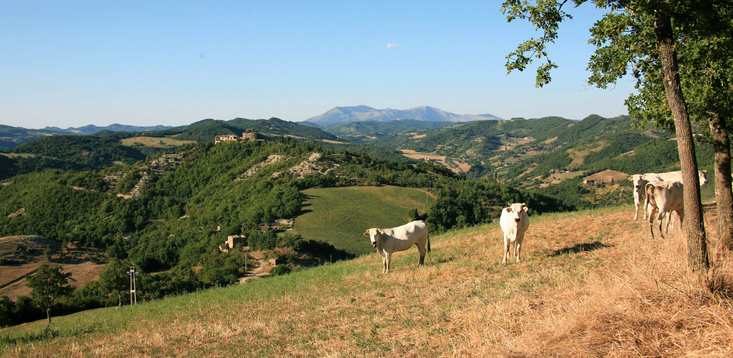
The road is flat and in good conditions, you continue straight on, shortly after you can admire the Gubbio Valley on the left and notice the first isolated building on the right. After 4 km you start climbing and at the first fork you turn right, always following the direction of San Faustino. Immediately after on the right you will notice a stone with the inscription Santa Certa (do not turn right) always continue straight on. After about 2 km the road becomes paved in some sections, on the left you can see a farm. Sooner or later, either before or after the building , you will see splendid Umbrian Chianina cows grazing. After about another 2 km (8 km from the junction with the unpaved road) you meet a crossroads, turn right. Along the way, on the left, you will notice a small building painted white; you then take the dirt road that descends, and after about 1.3 km from the crossroads, you will find yourself opposite the beautiful Resort of San Faustino. At the forefront of the resort on the right you can see the pool. If you are not tired and feel like continuing along a longer trail you can take the dirt road that climbs, and pass between the parking lot and the Resort. Alternatively, at the fork, before the Resort, you can follow the white-red arrow CAI signs indicating the path 116 on the right and you reach the locality Carpini. From there you can resume the county road SP 201 to return to Pietralunga.
(See part of the description of the trekking itinerary on foot Carpini –Tre Ponti-San Faustino in the last part “ After passing the Abbey…..”). If you, instead, follow the white-red arrow CAI signs heading left, after a few metres uphill, you will see the Casanuova building on the right; then you continue on the unpaved road until it ends. At this point you have two possibilities: the first is by going down the path CAI 116, but beware, there are a series of gates that must be carefully closed after passing since there are Chianina cows grazing. However, this is the right direction for those who like biking along dirt paths and gravelled roads (Please check the description of the trekking itinerary on foot: Carpini-Tre Ponti-San Faustino in the initial part. Remember that you will follow it in the opposite direction). As a second possibility, you can choose a longer trekking route, you turn left before the small gate and take a dirt road; then you continuing in that direction you reach the farmhouse “Ginestra”. Here the county road SP 203 begins, a beautiful ridge road from where you can admire, on the right, the charming village of Montone, and on the left the Valley towards the stream Assino. You continue straight on and turn right at the next fork, the road descends and after 1 km from the fork it becomes unpaved and a tough climb of about 300m begins until you reach the intersection with the paved road. Here you turn right again, while admiring Montone on the left, after about 1.8 Km, you turn left and continue along the paved road to the junction with the county road SP 201, from here you will follow the direction of Pietralunga. At this point if you are tired you continue along the main road; on the other hand, if you feel like continuing to enjoy the unspoilt nature of the Carpina Valley you turn left at the first intersection and follow the direction “Osservatorio Astronomico”. Soon after the bridge you continue on the right and from here you proceed straight on along the road bordering the stream Carpina, towards Pietralunga. The road is unpaved with slight ups and downs until you reach the fork at “Caigisti”, after passing the “Il Pioppo”, the countryhouse there, you turn right always in the direction of Pietralunga.
|
Period: All year round, except for winter months |
Condition signposting: signposted with white/red painted arrows. Status maintance: Length: 18 KM Difference: 650 m Duration: 5h 45 Download PDF Download GPX Download KML Download KMZ |